Ilwis
Описание
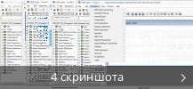
Perform vector and raster processing to analyze and present geographic water and land data. Integrate image feeds, vector graphics, thematic elements, and other content into the current project, edit and calculate specific values, import and export info, etc.
Вы можете бесплатно скачать Ilwis 3.8.6 с нашего сайта. Файл установки занимает 27.2 MB на вашем диске.
Наша антивирусная программа проверила эту загрузку и признала ее полностью безопасной.
Название установочного файла программы обычно следующие: Ilwis.exe, Ilwis30.exe или IlwisClient.exe и т.д. ПО принадлежит к категории Образование, а точнее к подкатегории Наука.
Ilwis отлично работает на 32-бит Windows XP/Vista/7/8/10/11. Самые популярные версии программы: 3.8, 3.7 и 3.6. Это бесплатное программное обеспечение принадлежит 52°North Initiative for Geospatial Open Source Software GmbH.
От разработчика:
ILWIS (The Integrated Land and Water Information System) is a remote sensing and GIS software which integrates image, vector, and thematic data in one unique and powerful package. ILWIS delivers a wide range of features including import/export, digitizing, editing, analysis, and display of data, as well as the production of quality maps.
Мы предлагаем оценить другие программы, такие как Pentaho Data Integration, Integrated Data Viewer или Pervasive Data Integrator, которые часто используются вместе с Ilwis.


